|
|
Home / Engineering survey
|
Engineering survey
Types of survey:
- operations comprising topographical survey;
- operations comprising site investigation survey;
- operations comprising hydrometeorological survey;
- operations comprising environmental engineering survey;
- operations comprising geotechnical survey (delivered as a part of the site investigation or separately on a geologically investigated territory for construction of separate buildings and structures);
- investigation of the foundation soils of the buildings and structures.
|
|
|
Types of operations:
- development of the geodetic control grid;
- geodetic monitoring of deformations and settlement of the buildings and structures, surface movement and hazardous natural processes;
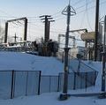
- plotting and update of the topographic plans scaled 1:200 - 1:5000, including those in a digital format, survey of the under4ground utility systems and structures
- route survey of the infrastructure lines;
- hydrographic survey operations;
- special geodetic and topographic survey for construction and reconstruction of buildings and structures;
- engineering survey scaled 1:500 - 1:25000;
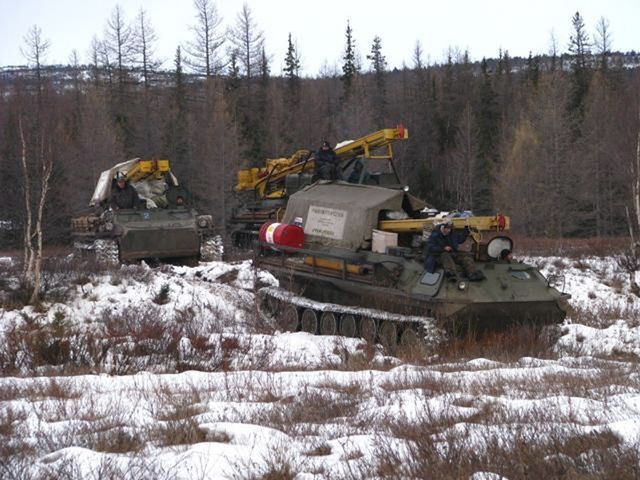
- mine drifting and sampling, lab survey of the soil mechanical properties and water chemical properties;
- of hazardous geological and engineering-geological processes and subsequent development of recommendations pertaining to ground protection;
- hydrogeological survey.
|
|
|
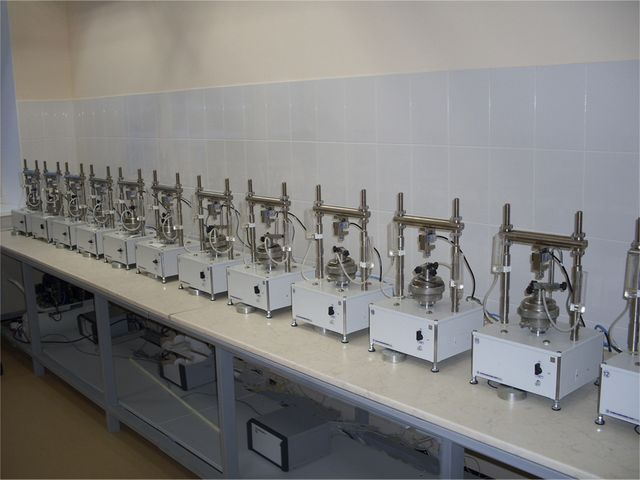
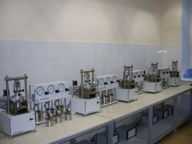
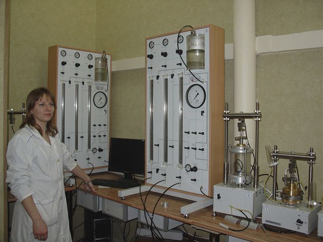
Physical, chemical and mechanical properties of soils are investigated in a certified ground chemical lab. The lab has in its disposal a necessary complex of the up-to-date equipment and instruments to identify the physical, mechanical and corrosive properties of soils as well as to complete the water chemical test and the water extract test during site investigation. Technical equipment and qualified staff are the quality guarantees of the completed surveys.
The soil lab investigates rocks, sand clays and ground waters. The list of the identified parameters is sufficient and provides all necessary information for site investigation. It includes the following parameters:
- density;
- natural moisture;
- liquid and plasticity limits;
- grain-size composition;
- filtration coefficient etc.
|
|
|
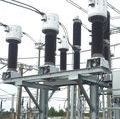
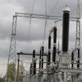
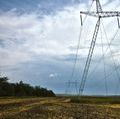
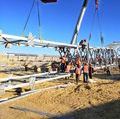
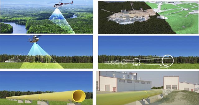
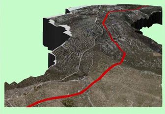
Topographic operations on the power transmission line at the Trunk Gas Pipeline, Skovorodino-Khabarovsk site
|
|
EXAMPLES OF USAGE OF THE AERIAL SURVEY MATERIALS
|
|
|
For power generation sector
|
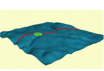
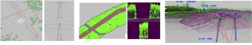
| Image and analysis of the results of the power transmission lines aerial survey |
|
FOR DEFENCE AND LAW ENFORCEMENT AUTHORITIES

|

|
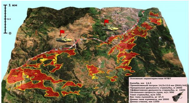
| Calculation of firing sectors in accordance with the weapon performance data |
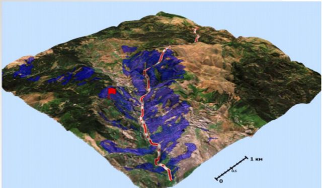
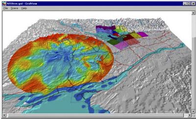
Calculation of visibility zones from a local point |
|
FOR TELECOMMUNICATION COMPANIES
|
| Design and reconstruction of the cable communication lines. Automated positioning of the tangent poles on the alignment with provisions for objects and exclusion areas crossing the communication line. Radiovisibility calculations on the basis of a highly accurate terrain model and local objects |
|
|